


TAMAROA 1 Voting District, Perry County, Illinois
About
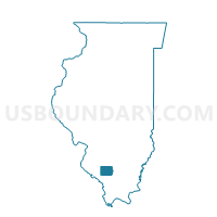
Outline

Summary
| Unique Area Identifier | 573958 |
| Name | TAMAROA 1 Voting District |
| County | Perry County |
| State | Illinois |
| Area (square miles) | 40.45 |
| Land Area (square miles) | 40.43 |
| Water Area (square miles) | 0.02 |
| % of Land Area | 99.96 |
| % of Water Area | 0.04 |
| Latitude of the Internal Point | 38.14874120 |
| Longtitude of the Internal Point | -89.17942940 |
Maps


Graphs
Select a template below for downloading or customizing gragh for TAMAROA 1 Voting District, Perry County, Illinois


Neighbors
Neighoring Voting District (by Name) Neighboring Voting District on the Map
- BALD HILL 1 Voting District, Jefferson County, IL
- BLISSVILLE Voting District, Jefferson County, IL
- DUBOIS 1 Voting District, Washington County, IL
- GOODE 1 Voting District, Franklin County, IL
- GOODE 2 Voting District, Franklin County, IL
- SUNFIELD Voting District, Perry County, IL
- TAMAROA 2 Voting District, Perry County, IL
Top 10 Neighboring County Subdivision (by Population) Neighboring County Subdivision on the Map
- Goode township, Franklin County, IL (2,715)
- Sunfield precinct, Perry County, IL (1,112)
- Tamaroa No. 2 precinct, Perry County, IL (804)
- Bald Hill township, Jefferson County, IL (767)
- Du Bois township, Washington County, IL (748)
- Tamaroa No. 1 precinct, Perry County, IL (711)
- Blissville township, Jefferson County, IL (404)
Top 10 Neighboring Place (by Population) Neighboring Place on the Map
Top 10 Neighboring Elementary School District (by Population) Neighboring Elementary School District on the Map
- Community Consolidated School District 204, IL (4,050)
- Ashley Community Consolidated School District 15, IL (2,041)
- Tamaroa School District 5, IL (889)
Top 10 Neighboring Secondary School District (by Population) Neighboring Secondary School District on the Map
- Pinckneyville Community High School District 101, IL (11,278)
- Nashville Community High School District 99, IL (8,925)
Top 10 Neighboring Unified School District (by Population) Neighboring Unified School District on the Map
- Du Quoin Community Unit School District 300, IL (9,353)
- Sesser-Valier Community Unit School District 196, IL (4,387)
- Waltonville Community Unit School District 1, IL (2,089)
Top 10 Neighboring State Legislative District Lower Chamber (by Population) Neighboring State Legislative District Lower Chamber on the Map
- State House District 117, IL (110,775)
- State House District 115, IL (105,561)
- State House District 107, IL (102,096)
Top 10 Neighboring State Legislative District Upper Chamber (by Population) Neighboring State Legislative District Upper Chamber on the Map
- State Senate District 58, IL (216,350)
- State Senate District 59, IL (209,843)
- State Senate District 54, IL (204,199)
Top 10 Neighboring 111th Congressional District (by Population) Neighboring 111th Congressional District on the Map
Top 10 Neighboring Census Tract (by Population) Neighboring Census Tract on the Map
- Census Tract 503, Jefferson County, IL (4,389)
- Census Tract 9504, Washington County, IL (4,231)
- Census Tract 301, Perry County, IL (3,121)
- Census Tract 401, Franklin County, IL (3,047)
- Census Tract 304, Perry County, IL (2,651)
- Census Tract 305, Perry County, IL (2,398)
Top 10 Neighboring 5-Digit ZIP Code Tabulation Area (by Population) Neighboring 5-Digit ZIP Code Tabulation Area on the Map
- 62832, IL (9,208)
- 62884, IL (2,940)
- 62888, IL (2,135)
- 62808, IL (1,457)
- 62883, IL (591)
- 62831, IL (573)